The Region
The Village of Mastatal
Mastatal has a population of about 110 people and typifies rural Costa Rica in this part of the country. Most of the inhabitants live from the land though this is changing with the growing importance of tourism and the degradation of the lands due to overgrazing and intensive
farming. The people of Mastatal are generally reserved and incredibly kind. Many families have lived in the area for generations. There is a church, an elementary school, a local carver, a middle school, a small restaurant, two village stores, a bar, and a community center. There are also a number of other local businesses including Finca Villas Mastatal, La Iguana Chocolate, and Finca Siempre Verde.
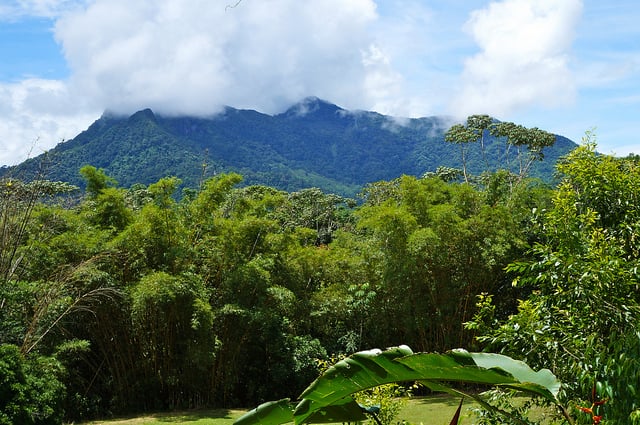
La Cangreja National Park
In early 1991 (well before we came here), an enthusiastic young student from Duke University
named Ann-Marie Parsons, at the time an intern with the Institute for Central American
Development Studies (ICADS), came to Costa Rica to study the virgin forest stand located in the
former La Cangreja Reserve, just outside of Mastatal, and bordering our property.
Ann-Marie's research confirmed the existence of a multitude of plant and animal species, many endemic to Costa Rica, several nearly extinct, including two tree species endemic to this small forest alone. La Cangreja National Park and the property that makes up Rancho Mastatal contain the last patches of natural, unaltered forest left in the county of Puriscal. As a result of her studies, Ann-Marie proposed to preserve La Cangreja under a long-term management, protection and sustainable use plan. Tragically, she drowned after completing her analysis, and is buried in the local
cemetery overlooking Cerro Cangreja.
In the years following her death, a number of ICADS students and other interested professionals continued Ann-Marie's work. La Fundacion Ecotropica, a local, nonprofit institution with whom Ann-Marie collaborated, took on the management responsibilities of the project. Motivated individuals like you can step in and help to continue the important work that was started in the early 90's. We believe that in part by way of projects initiated from interns, this area could become one of the country's premier conservation sites and examples of sustainability. There is a great deal of work to be done, and that is one of the reasons it's such an exciting time to be here.
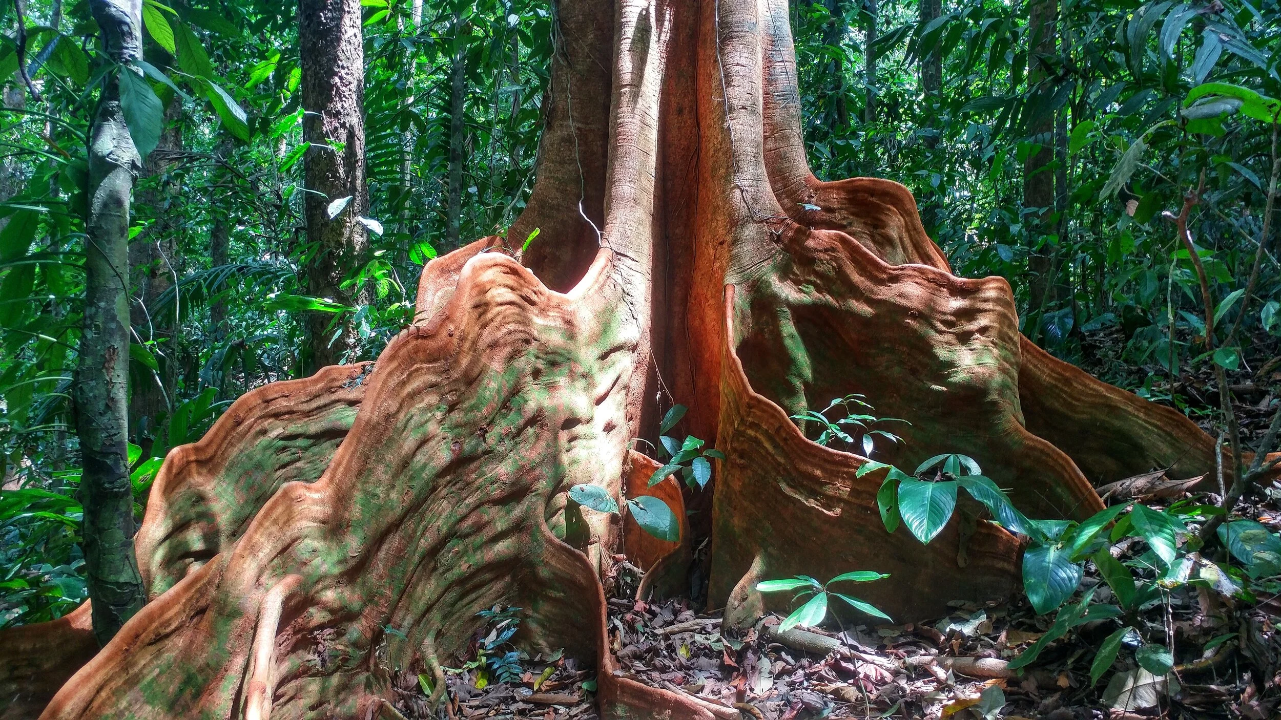
La Cangreja is the last refuge of virgin forest in a region that at one time extended all the way to the
Peninsula de Osa in southern Costa Rica. Over 2000 plant species, many of South American origin, may be found in this small but species-rich area. Plant species endemic only to La Cangreja and the Peninsula de Osa, and two species endemic to La Cangreja alone, live in this biological paradise. These two endemic tree species, Ayenia mastatalensis and Plinia puriscalensis, are members of unique families of plants. The latter produces its fruit from the trunk. These two species belong to six tree types first discovered in La Cangreja. The other four species also exist in the Osa Peninsula.
Aside from its genetic importance, La Cangreja also helps ameliorate the region's climate. The Costa Rican government declared La Cangreja a protected zone in 1984 to preserve its water
and soil quality.
Today, not only water quality but also water quantity are threatened. Deforestation has caused the water flow of one river in the zone, the Rio Negro, to shrink three times in size from what it was just 30 years ago. People from the surrounding towns of Mastatal, San Miguel, Concepción, San Carlos (Zapatón), Túfares, and San Martín, as well as the hamlets of Vara Blanca, Alto Pérez, and Bajo Pérez feel the effects of this phenomenon, since several of them receive water from the river.
The reserve was promoted to national park status in 2002. La Cangreja's role in maintaining the water supply is not its only effect on the people of the region. Along with its status as a protected zone (and subsequently National Park) came regulations which restrict farmers from utilizing the land in customary ways. For instance, they may only cut down trees for domestic use, and need a permit to do so. In addition, hunting is prohibited, although, unfortunately, poaching continues. Certain crops, like cacao, cannot be cultivated because they put pressure on the ecosystem. These
regulations mean farmers cannot extend cultivated plots and are becoming increasingly impoverished as fertility and yields of cultivated land have diminished.
A questionnaire distributed to the farmers living in La Cangreja showed that most are in favor of selling their land. With the funds it raises, the Fundación Ecotrópica and MINAE will purchase land
from willing sellers. Once acquired, the land will be conveyed to the Republic of Costa Rica, and the government will delegate to the Fundación Ecotrópica the function of managing it. The Fundación
will work with an autonomous public agency, the Institute for Agrarian Development (IDA), to relocate former owners who also previously resided in the Zone to land more appropriate for
agriculture.
If La Cangreja is not protected, it may fall victim to the same pattern of exploitation that the barren hills surrounding the national park have suffered. The diverse and threatened species within its boundaries are a resource too important to lose. Furthermore, as scientists have only studied La Cangreja from its lowest point around 1,300 feet (400 meters) to an elevation of about 2,000 feet (600 meters), additional plant species probably remain undiscovered at higher altitudes extending to the summit at 4,281 feet (1,305 meters). The survival of La Cangreja requires a realistic plan of action for protection, management, and sustainable use which this proposal will provide.
For more information, see here. Follow the links below for an extensive species list and updates on birding in the area as well as an article of the significance of the National Park.
The Biological Importance of La Cangreja
Manuel Antonio National Park
This is one of Costa Rica’s most visited National Parks and is located 1.5 hours by car
southeast from Rancho Mastatal. Sandy beaches, cliffs, points, ravines, rivers,
rainforest, varied wildlife and a hot climate are some of the components of the Manuel
Antonio National Park on the Central Pacific Coast, 7 kilometers south of the service
town of Quepos and Quepos Harbor. It is traditionally an agricultural region, based on
a plantation economy, and has been extensively altered since the l9th century. The
forest, which used to cover vast tracts, was cut down, and the few remaining stands are
conserved today in a protected wilderness area. There are a host of restaurants and
hotels that service the area.
The predominant species in Manuel Antonio are the cotonron, bully tree, nargusta, black locust, cow tree, Santa Maria, and silk cotton with specimens as tall as 30-40 meters. The wildlife in the forest habitat consists mainly of white-faced capuchin, howler and squirrel monkeys, pacas, grey squirrels, raccoons, white-nosed coaties, and two- and three-toed sloths. Some of the bird species that live in the park are the brown pelican, laughing falcon, black-collared hawk, white ibis, white-bellied chachalaca, blue-crowned, manakin, fiery-billed aracari, green kingfisher and jacana.
There are other habitats besides the forest, such as mangrove swamp, lagoons, littoral woodland and island vegetation. The park houses a total of 109 species of mammals and 184 of birds. Crabs abound in the small intermittent lagoons covered with gramineous plants and heliconias, a typical species being the brightly coloured mouthless crab that migrates to the beach at the beginning of the rainy season. The lagoons are also home to caymans, boa constrictors, grass snakes, white-nosed coaties and raccoons. The islands and islets provide an important refuge for seabirds, especially common terns and magnificent frigatebirds. Brown pelicans inhabit Mogote and anhingas use Olocuita and Larga Islands as a mating and nesting site. In the waters around the cliffs of volcanic-sedimentary rock, scientists have identified 19 species of coral, 78 of fish, 24 of crustaceans and 10 of sponges. Manuel Antonio National Park was created as a recreation area and from this point of view it provides certain facilities, such as picnic areas and lookouts. Among the scenic sites, some of the most attractive are: the tombolo at Cathedral Point, a long, sandy strip that joins what was
Cathedral Island to the mainland; the cove at Escondido Harbour with blue-green waters surrounded by underwater caves and cliffs pounded by the surf; and the beautiful beaches where sometimes olive ridley and green turtles come to lay their eggs.
Carara Biological Reserve
This beautiful Reserve is located about an hour and forty-five drive from Rancho Mastatal. Carara is a region of mountain ranges, marshes, meanders, forests, swamps, rivers and ravines, of crocodiles and macaws, of archaeological sites, and a very hot and humid climate. This small reserve of 4,700 hectares is located 4 kilometers southwest of the city of Orotina, as the crow flies, in the lower river basin of the River Grande de Tárcoles, which waters the Central Occidental or
Westem Valley. It ranges from the rolling alluvial lowlands to the steep slopes of volcanic and sedimentary hills that rise 634 meters above sea level. The terrain is carpeted with grasslands and
forests of predominantly evergreen species, which stand out sharply in a region that has
been heavily deforested and developed. The forests on the slopes are composed of species
such as the espave, wild fig, silk cotton, quamwood and purple heart. The forest mass on
the lowlands has little diversity although palm trees are abundant. Their frequently seen stilt
roots are signs of occasional floods. The gallery forests that grow along the riverbank are thick
and tall, with few, species, mainly the espave, but their appearance likens them more to a
rainforest type of growth. The marshes are covered with water hyacinths, a plant that
typically grows in shallow waters rich in nutrients or in polluted lakes. The predominant species in the altered areas are deciduous, mainly quamwood and thorny viscoyol palms.
These tropical dry forests of Carara are highly susceptible to forest fires, an occurrence that takes place almost every year from January to April, the season of strong winds. Despite the fact that the reserve is small, remote and frequently visited by poachers, it houses a very diverse wildlife. Over 100 pairs of scarlet macaws, perhaps the most beautiful birds on the Pacific side of Costa Rica, live and nest in the forests. Towards dusk they can be seen returning to their roosts in the mangrove swamps at the mouth of the River Grande de Tárcoles. The reserve also provides shelter for howler and white-faced capuchin monkeys, whitetailed deer, red brocket deer, collared peccaries, pacas, rattlesnakes and fer-de-lance snakes. Some of the birds of the region are the black guan, great egret, turkey vulture and laughing falcon. The swamps, an area where the river overflows, are where cayenne wood-rails, raccoons, lizards and several species of snakes and frogs find food and shelter. Anhingas, blue-winged teals, roseate spoonbills, Mexican tiger-bittems and a large colony of boat-billed herons (a curious bird with a beak in the shape of a boat) can be seen in the lagoon formed by a meander in the ancient river basin. Crocodiles, which can grow 3 meters long and are an
endangered species, lie on the shore here and also on the little beaches along the River Grande de Tárcoles.
It is easy to get to Carara Biological Reserve as it lies on the road between Orotina-Jaco-Quepos-Manuel Antonio. Park Headquarters are located 2 kilometers south of the bridge over the River Grande de Tárcoles.
Other protected areas in the area include:
Cerro de las Vueltas Biological Reserve
La Cangreja National Park
Zapatón indian reserve
Los Santos forest reserve
Fernando Castro Cervantes wildlife refuge
Montes de Oro protected area
Rio Titives protected area
El Rodeo protected area
Cerro Escazu protected area
Cerro Turubares protected area
Caraigres protected area
Cerro Nara protected area
Quitirrisi indian reserve